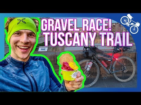
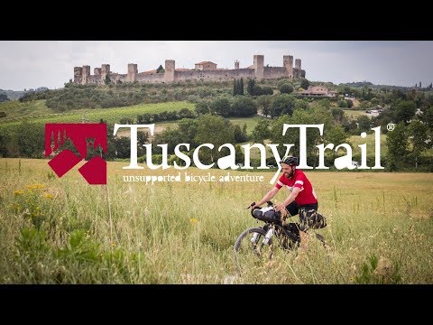
The TuscanyTrail is a self-supported race for adventure-hungry bikepackers and mountain bikers. The wild ride goes once across the beautiful Tutuscany. The participants often ride over gravel roads and challenging trails through nature. Read all about the Tuscany Trail experience in this article!

The route also skilfully passes through well-known sights such as Florence and Siena. In total, there are more than 550 kilometres and 9000 metres of altitude to overcome on the route.

This is my second time riding the Tuscany Trail Race and I love it. Find out in this article everything about: how to get there, equipment and my detailed experiences on the route.
The official promo video of the Tuscany Trail gives the impression that this is a coffee ride over famous light gravel roads (Strade Bianche) of Tuscany.
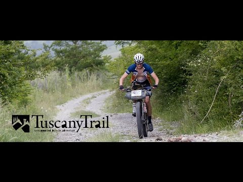
However, it becomes clear to every participant from the very first kilometres: the Tuscany Trail demands a lot from you as a rider! Here both endurance and skill are required and it goes permanently over MTB trails, gravel tracks, dirt roads and also steep vineyard tracks. To loosen up, every now and then we also ride on the road.
A look at the profile of the Tuscany Trail course clearly shows the ambition of this bikepacking race:

I’m still feeling the effects of the wild ride through Tuscany now – a few days after I crossed the finish line. My bike navi showed a total of 547 kilometers and 8900 meters of altitude at the finish line. The village of Radicofani is at the highest point of the trail through Tuscany, at almost 800 metres in altitude.
Both man and bike were challenged properly for almost the entire route. This is clearly part of the Tuscany Trail experience.
In total it took me 4.5 days to complete the trail. A good pace. At this speed you are sporty and performance-oriented and you also have enough time to enjoy the unique landscape.

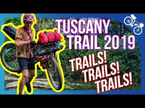
The Tuscany Trail has a lot to offer in terms of scenery: You ride through a unique and almost always challenging landscape.
Consisting of:
- Mysterious forests
- famous cities and historic villages
- varied vineyards
- lonely (gravel) roads
- challenging trails
At the same time, the sporting challenge rides along at all times.
If you want to be faster than the 4.5 days I mentioned, you have to save on sleep and I was already at the lower end of that with about 6h per night.
Tuscany Trail Experience
Day 1 – Massa to Florence
On a sports field in Massa the registration for the Tuscany Trail took place the day before: The starting documents were handed out and a speaker announced the last information. A euphoric mood could be felt during the whole time and all bike enthusiasts were already full of anticipation for the start the next morning at 8 o’clock.

So about 700 like-minded people were gathered on the sports field. The event already felt like a meeting among like-minded people. There was shop talk, bikes were marveled at and final tips were given. Fortunately there were many possibilities to pitch your own tent on the sports field and at night it was nice and quiet.

Shortly before 6am the first riders crawled out of their tents and bivy sacks. The anticipation and euphoria was huge and I left early in the direction of Piazza Aranci, the market place of Massa. The place filled up quickly and shortly before the start was filled with riders in colorful jerseys on a wide variety of bikes. The field seems to be wildly mixed: from bikepacking beginners to top-equipped and well-trained veterans who have been to several self-supported races and also have Tuscany Trail experience.

The euphoria grew immeasurably. I was still with two Austrians at that time. We had met the day before at the airport in Stuttgart and in Pisa and wanted to start together. But in the turmoil we quickly lost sight of each other and I didn’t meet them again on the track.

Then the Tuscany Trail 2019 finally started: There was a short speech by the organizer. Then more than 700 riders rolled out at the same time. It was out of Massa and towards the mountains. The adrenaline and sporting ambition could be felt everywhere. Forced by the narrow streets, the speed in Massa was still manageable. As we left the city, the field picked up speed considerably.
You could tell: even though the Tuscany Trail is not a race but a bikepacking adventure, the sporting ambition rides along here.
The field was led by the ultra-endurance riders. They are usually packed very minimally and want to do the trail on time. The first one usually finishes in under 48 hours.
Back to the peloton: The first kilometers were on a straight line and the riders were still close together. I navigated with the Wahoo ELEMNT BOLT. I plotted the route from the start. But at that time it was not necessary to look at the navigation system, because you could just follow the car in front.
For 20 kilometers we went straight on the best road. Then began the first climb up the mountain to Pedona: from sea level to about 320 meters altitude within 5 km. Many meters of altitude on steep climbs on a short distance, that distinguishes the Tuscany Trail!


The climb got steep quickly and the road was still good. I made good time. At the second climb up to Montignano the good road said goodbye: It went on forest paths and MTB trails.

The fun and the effort increased in equal measure 😉 Many of the riders understandably started to push. At the latest at this first brutal climb it becomes clear to most: The tour is partly torture and suffering is part of the Tuscany Trail experience.

After the first trail interludes we continued on asphalt in the direction of Lucca. 55 kilometers were done and I allowed myself a short break for a photo stop and a focaccia. Quickly I drove on, because I wanted to reach Florence that day and until then there were still more than 100 kilometers on the program.

I also knew: I still had a good wall coming up! 400 metres in altitude in just a few kilometres. The ground was stony to blocky and moreover the gradient exceeded the 20% mark! A true statement to the calf then!
The course before Vinci was totally muddy and most of it was on dirt roads. My Bombtrack Beyond did very well until here, I had a lot of fun and the bike was already on the first day through the mud hardly recognizable.


There was hardly any shade to think of on this section of the track. In addition, the sun sizzled down on me with temperatures of over 30 degrees. Thanks to a long merino wool top and 3/4 cycling shorts there was fortunately no danger for skin and rider and the next really steep hill didn’t come my way until Vinci.
The really steep climb started shortly before Vinci and went over the dirtroads. Arriving in Vinci I already felt the first signs of exhaustion. Fortunately, the euphoria was greater than the exhaustion and I still had enough strength for the summit attempt! So I treated myself to a snack, as well as a photo stop, and continued on my way.

It was about 6pm: there was only one direction for the next few kilometres. Steeply upwards! I worked my way over gravel and rocks towards the summit. First riding and due to the extreme climb later pushing.
On the ascent I met Werner again: He and I had already met in 2017 at the Tuscany Trail and I was quite surprised to meet him again this year. We talked for a while during the ride and the reunion made me even more motivated to reach Florence today.
The descent to Signa was then again very technical and trail-heavy. Here the Tuscany Trail once again showed its true side!
From here we continued for about 15 kilometers to the heart of Florence. The sun was already setting and I really wanted to take some photos in the city with these best light conditions. So I pedaled hard again!

In the city still the photos shot, held thereby with a group of Italian women small talk and ate with two sympathetic Austrians in the city center a fast Pizza.

With the two Austrians I rode until about 22 o’clock on a field a few kilometers behind Florence. When we set up camp for the night, there were 156 kilometers and more than 2000 meters of altitude on the Wahoo ELEMNT Bolt!

To my delight, Werner also happened to come across our night camp and joined us with his bivouac sack. The next morning the three of them drove on shortly after 5am and I was called a late sleeper because I „slept in“ until 6am – I can deal with that 😉
Day 2 – Florence to Monteriggioni
On the second day the plan was to ride from Florence via Sambuca to San Gimignano. At first glance, the route sounds like a Tuscany dream from an Italy travel guide. In reality, this stage was characterized by steep climbs and challenging trails!
Already in the early morning the climbs were a challenge for the calves and the technical trails demanded highest concentration on the descent.


One of the most fun and intense sections where progress was very slow. All in all, 1222 metres of altitude difference had to be mastered over 49 kilometres to Sambuca.

I got up the climbs just fine. The day before there were some sections with 20% incline where riding was impossible. On the second day the climbs were a little less steep and I was also well trained. The first day had been very challenging, but I still felt very well recovered.
The second day was also a long time through the most beautiful vineyard landscape. Of course, we were sent up and down the trails again. In between there were also sections where it went for a short time straight out of asphalt. Making kilometers was therefore also possible.

The weather is nice and with temperatures beyond the 30 degree mark also very hot which I hardly mind. I like it better too hot than too cold.
By noon, most of the steep descents had been mastered. In a small bar I treated myself to two focaccias and there I met Marc, a German living in beautiful Switzerland. The two of us rode the trail together from here on out.

For the city of Sambuca we actually wanted to take some moments for a short sightseeing. Marc and I, however, were fully focused on the trail and engrossed in our conversation that we passed through Sambuca without noticing. In the meantime the sun was burning relentlessly, so that the sweat ran down on us like from a waterfall. Fortunately we still had some reserves to tackle the 30 kilometers and 769 meters of altitude difference to San Gimignano.
San Gimignano was perched on top of a mountain and was already noticeable from afar by its towers.

Scarred by the trail, we arrived in town high on the mountain: Sweaty clothes and dirty bikes. This made us and the other Tuscany Trail riders instantly recognizable.
To regenerate our aching muscles, we treated ourselves to an ice cream and a short break in the medieval town.


The most strenuous stage of the Tuscany Trail was behind us and we were proudly celebrating our triumph. The makers of the Tuscany Trail have planned the route really cleverly and as we continued the route went through the town’s market square.
There we could marvel at the main attraction, the many gender towers.

Afterwards we left the crowded streets of San Gimignano to roll on highly motivated towards Siena. However, we didn’t quite make it there that day.
The following route led us further through unique wine-growing areas, through enchanted forests and of course over bumpy trails.
A few kilometres after the town, a river also wanted to be crossed. An action that I always love especially 🙂

As darkness fell late in the evening, we were still on blocked trails. The paths were partly dry from the heat, partly also muddy and we made much faster progress by driving and pushing than in the morning.

35 kilometers and 600 meters of altitude after San Gimignanos we spotted another highlight of the bikepacking tour: the tiny village of Monteriggioni. Well protected by high walls, it lies on the top of a mountain.
This one is far and wide one of the steepest: With a gradient of more than 20% you have to push your way up the hill into the village.

In Monteriggioni there are, fortunately, some small and fine restaurants. There we strengthen ourselves with pizza, pasta and a more than deserved beer.

At night it is stealth camping and we pitch our tents in a small park on the outskirts of the village. Nobody feels disturbed by our presence and so we fall asleep right after dinner….
Day 3 – Monteriggioni to Radicofani
…our night camp at the edge of the city we dismantle directly with the sunrise again. We know that only a good 10 kilometres, a few metres of altitude and some trails separate us from Siena.
There we want to enjoy the morning quiet atmosphere and treat ourselves directly to breakfast.
After enjoying the view from the mountain we immediately got on our bikes. It was time to tackle the last kilometers towards Siena.


We left very early in the morning and the weather was pleasantly warm, so we could start directly in the T-shirt. A few trails later we rolled into Siena, where apparently the tourist crowds were still asleep. Only a few commuters and city employees were already on the roads.
So we were able to drive into the city center quite relaxed.
We stopped at the highlight of the city: the Piazza del Campo! There we enjoyed the early morning atmosphere and it was time for the obligatory photos. Shortly after the piazza, we treated ourselves to an extensive and lengthy breakfast consisting of sweets, juices and other treats.
I have to say: my timing when driving through the cities couldn’t have been better. Florence on the first day I passed through in the late evening, just as the sun was setting. Loose rolling through the city was still possible there and the atmosphere was unique. Now in Siena in the early morning, the atmosphere was also magical and the city shone in its full glory.


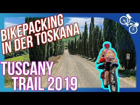
We left Siena and what followed was probably the most beautiful landscape Tuscany has to offer. Green vineyards, criss-crossed by the famous white gravel roads („Strade Bianche“) and cypress trees to the left and right of the path.
Exactly what one associates with Tuscany. We were riding with a group of Italians at the time and couldn’t get out of our amazement.
Part of the route here also crosses the long-distance trail Via Francigene, which runs from France to Rome.

For a few miles we also rode the legendary L’Eroica. This is a gravel road bike course that hosts an annual vintage road bike race. Only classic racing bikes with steel frames are allowed in this race.
With the thin road bike tires, the path is certainly a great challenge. With mountain bike tires we rolled fortunately relaxed over the wise gravel paths.

The day was one of our fastest in terms of mileage. Although we were rolling along well, Marc and I were getting tired. I remember it well: during a short break he was lying half asleep in the middle of the wise gravel road, dozing away. Later that day, I fell into a deep hypoglycemic hole and was briefly at the low point of my trail journey.

We really wanted to rock some more miles. Although both of us were already marked by the trail, we set ourselves a sporty daily stage: From Pienza we wanted to ride to the highest point of the Tuscany Trail.
So there were still 35 kilometers and 664 meters of altitude on the plan until we should reach Radicofani. The climb to Radicofani over loose gravel roads then proved to be hard work. Before that there were also two wide riverbeds to cross.

In the early evening, exhausted, proud and famished, we reached the highest point of the Tuscany Trail: Radicofani. Running water in a small village square made a cat shower possible – a great luxury on such a bikepacking adventure.
We treated ourselves to a hearty dinner at a pizzeria and then made ourselves comfortable in a backyard. I slept in my MSR Hubba NX as usual. Since it was so warm, the airy inner tent was enough for me. The other two only needed their sleeping mat and sleeping bag.

Day 4 – Radicofani to Albinia
There in the backyard we slept quite long. Our bodies were probably longing for a rest from the strains of the last days.
The destination for the day was Albinia, 112 kilometres away, directly by the sea.
We also knew that we had a few downhills ahead of us that day and the course should be doable in one day.
So we took it easy on this day and strengthened ourselves with an extensive breakfast in a bakery… Around 9 o’clock we rolled back on the trail.


On the next 10 kilometers we went downhill for 500 meters on a wide gravel road. The descent was a welcome reward for the previous evening’s exertions climbing this ramp.


Of course, this descent also required the highest concentration, because we were rushing down the slope at high speed. The following kilometers led us less on trails and more on gravel roads and also a lot on asphalt. Accordingly, we could make good kilometers here.

Around noon we reached the beautiful mountain town of Sorano. A city in the middle of a spectacular mountain panorama. Those who want to reach or leave them cannot avoid numerous serpentines. The pizza in Sorano tasted so good that the break was longer than planned.
However, filling up the energy reserves turned out to be a good idea, because the 72 kilometres that now follow to Albinia at the sea are rather sparsely populated and there are few possibilities to supply oneself with supplies.

The ancient town of Pitigliano was to be the next stage destination and was only 13 kilometres away. From my participation in the 2017 Tuscany Trail, I knew that the trail there was a steep ramp, loose footing, and then lots of stairs into town.
All of a sudden, however, we admired the city together with the wooded mountain landscape from the front. I was astonished, because due to a navigation error we had bypassed the city and noticed it too late.

I kept experiencing on the Tuscany Trail that Komoot must have changed the loaded track. Although it was selected during the upload, the track should not be adjusted. During the tour I talked to some fellow riders who confirmed this strange behaviour.
Our plan was still to reach Albinia. Until then there were still 59 kilometers and 762 meters of altitude to overcome. On the map, it looked like the trail was all downhill from here. Of course, there were still a few steep gravel roads to climb on the way there.
Over the next 25 kilometers, there were a total of four steep walls that we tackled. It now looked like it was all downhill for the 34 kilometres to the sea. However, we had made the calculation without the wind, which blew us from the sea up to our arrival now against.
Through the long grassland we rolled from here towards the coast. Arrived in Albinia we decided for a well maintained and large camping site directly at the Italian coast. The unassuming restaurant rewarded us with one of the best pizzas I had eaten during my visit to Tuscany.
The campground shower was of course also a boon.

Day 5 – Albinia to the finish
Only one last obstacle separated us from the finish line today. We knew that the 948 meters of altitude on 51 kilometers would be brutal! Because the rock island Monte Argentario on which also the village Porto Santo Stefano with 375 meters height lies, let already from a distance trails of the finest guess.
One thing we knew: no matter how great the ordeal. Today we’re going to the finish line!

When we left at 7 o’clock, the hot weather already announced itself. Nevertheless, we treated ourselves to another quick breakfast and an espresso in Porto Santo Stefano. After that we went straight to the mountains.
Since we arrived at the campsite early the night before, we were well regenerated and thus felt in top shape. On top of that, there was the euphoria and anticipation of the finish.

So we pedaled up the mountain higher and higher. We were sweating and amazed: On the one hand, after each ascent there was a tough trail section that once again required full concentration. The descents were particularly dangerous here due to rough and loose stones.

On the other hand, there were many places to admire the impressive views over the island and the sea.


About two hours kept us busy with the challenging course on the island and it was a constant up and down. At some point we left the gravel trails and could enjoy a wonderful descent to the port of Porto Ercole.
We had the almost endless view over the sea to our right the whole time. Continuing on the plains, we rushed through the middle of a cedar forest near Ansedonia.

Now the goal was within reach: A few more kilometers lay between us and Capalbio. A last short climb, then another short and unspectacular stretch directly along the coast.
Then the big moment had come and the three of us rolled over the finish line in Capalbio. At about 13 o’clock we arrived, with an outstanding feeling and the consciousness to have conquered the 550 kilometers and 9000 meters of altitude.
Full of pride, we immediately took a finish line photo and toasted to what we had accomplished and to our Tuscany Trail experience! With Marco and Philip I had a lot of fun on the trail and I found it very helpful and motivating to ride with them.

Placings were completely eliminated this year at the Tuscany Trail. Probably I was with the time still in the front third.
But the ranking was not the point of this bikepacking adventure. I wanted to push man and machine to the limit. Combine a great cycling adventure with a holiday and gather lots of new inspirations and impressions. That’s exactly what I did 🙂
The route of the Tuscany Trail is really very demanding. Probably some first-time riders underestimate the effort that has to be put in on the way from Massa to Capalbio.
If you want to reach the finish line very quickly, you will probably have to save on sleep on the Tuscany Trail and ride at least part of the way through the night. In any case, I find 4.5 days ideal if you want to combine pleasure and performance.

Tuscany Trail Experience – Conclusion and Report
The Tuscany Trail is a challenging bikepacking adventure for mountain bike enthusiasts. I highly recommend participating and for sure I will be back at the start of one of the future Tuscany Trails!
For those who prefer asphalt, there’s also the Tuscany Road in September (EDIT: The Tuscany Road event seems to no longer exist).
At this point I would like to draw a conclusion to my bikepacking equipment. Because once again I have also learned a lot:
At its core, my packing list has more than proven itself. I could take minimal less clothes next time but I wouldn’t change anything on the bike. I also didn’t miss a piece of equipment and felt well equipped in a variety of situations.
Also, I didn’t have a single breakdown on the trail.
In the following I will go into more detail about the important components:
Bicycle gears: I ride the standard configuration on my Bombtrack Beyond and am very happy with it. That is I drive a 2 x 10 circuit with front at the chainring 42 / 28 and rear at the cassette 11 / 36 teeth. This gear ratio was ideal for me on the trail and I also rode up very steep ramps with it.


As already described, I was very happy with my packing list. I would possibly leave one of the two long merino wool shirts at home to save some weight and volume again.
Bikepacking bags: For the large bags, I again relied on my tried and true Ortlieb bikepacking bags. I have had the bags for over two years now and they work very reliably and are waterproof to boot. Here on the blog I have also already tested the Ortlieb Bikepacking bags in detail.
The bags can be firmly lashed to the bike and offer an ideal volume. Only the spacer on the Ortlieb handlebar pulley is actually superfluous and therefore I often leave it out.
Bikepacking Top Tube Bag: Just before the Tuscany Trail, I picked up the Salsa EXP Salsa EXP Toptube Bag Top Tube Bag. With the purchase I have long been flirting and now I can say: The bag is a good choice 😉 With 1.2 liters it offers plenty of space, is waterproof and can be attached either by Velcro or with screws on the top tube.
Bike bottle cage (Stem Bag) from Decathlon: I had bought another small Stem Bag from Decathlon, with which I am also quite satisfied – especially given the low price. Meanwhile, my Revelate Designs Mountain Feedbag was delivered and I replaced the Decathlon Stem Bag.

Through a lot of trying out and testing I have now landed with this bag combination and am very satisfied with it. I was also very concerned about the waterproofness of all the bags (except the Steam Bag, of course).
Bonus: Tuscany Trail Bikes
Before a self-supported race like the Tuscany Trail, many riders ask themselves: Which bike is best for the Tuscany Trail and which equipment is suitable?
I’ve had the chance to experience Tuscany Trail twice now and come to the following conclusion: I was there in 2017 and this time in 2019. In the run-up to the race, I have been intensively occupied with the question, I have observed a lot and talked to the other drivers about the topic.
The most suitable Tuscany Trail Bike is in my opinion:
- 29 inch hardtail MTB
- with suspension fork
- Tires between 2.2 and 2.4 inches wide
- Straight handlebar
- Disc brakes
- large MTB transmission with 1×12 or 2×10 gears
Such a Tuscany Trail Bike corresponds to my ideas of the ideal bike for this event. At the end, everyone gets to answer for themselves which bike they ride on the Tuscany Trail.
On the track people went with the most different bikes: I observed a lot of trail MTBs, randems, crossers and touring bikes. There was what every kind of bike represented.
In 2017 I drove myself with a cyclocross with thin 28 inch tires and small transmission. To my astonishment I didn’t have a flat tire during the whole tour. However, I would not recommend the Tuscany Trail with a cyclocross to anyone, because a bike with thin tires has too little safety reserves for the demanding descents and too narrow a gear ratio for the steep climbs.
Ortlieb clearly dominated the bags. After that, Apidura and sporadic Revelate designs came immediately. A few other manufacturers were also on display.
For a better overview of which bike was ridden on the Tuscany Trail – here is a gallery. Have fun!


Film from the Tuscany Trail Team 2018
Video from Bombtrack
Bonus: Journey
The race starts at the Tuscany Trail in the Italian town of Massa. Fortunately, the city is conveniently located and easily accessible by several modes of transportation at once:
- By car: From southern Germany the way to Massa is not very far. From Stuttgart to Massa it is about 840 kilometers with a pure driving time of about 9 hours. There is also parking in Massa so you can leave your vehicle while you are on the trail.
- By train: Massa can also be reached by train. I did the journey through Italy by train with bike in 2017 and arrived in Massa after about 14 hours. Please note that you should book your train ticket early and that you will most likely have to buy a ticket for your bike for the section in Germany. Buy your ticket at least six weeks in advance! I was also planning to travel by train again in 2019 and the railroad had already sold all the bike tickets for this route.

- By plane: In 2019, I flew by plane from Stuttgart to Pisa. I have for the outward and return flight incl. Bicycle transport paid about 300€. Taking the bike on the plane was, as always, a bit stressful. However, with a little preparation and if you follow some tips, this is only a small hurdle. In Pisa at the airport and at the central station there is also a luggage storage for for example a bicycle case.At the airport the luggage storage costs 7€ per day (as of 2019) and at the central station 5€ per day (as of 2019). Luggage storage at the airport was a disappointment as they stopped accepting bags. At the main station, my EVOC bike bag (EVOC Bike Travel Bag XL bicycle case) was accepted in a friendly manner and treated well there.
- Per carpool: Carpooling with another rider and then driving to Massa is also an option. TIP: On the Tuscany Trail website, there is a list of participants for the current event each year. One option would be to look for the participant names on Facebook and contact them in advance. Bike enthusiasts are often easy to spot from your profile photo 😉
Have you ever ridden the Tuscany Trail or a similar event? Do you have any questions about this bikepacking event, my equipment or preparation?
Feel free to drop me a line in the comments!


