
Bike Navi Test 2021 – GPS devices for e-biking, touring, MTB, road biking & for bikepacking! The right bike navigator allows comfortable bike navigation, records routes, has a long battery life and facilitates structured training.
In this very detailed article, I’ll help you choose the appropriate GPS bike navigator for you. To that end, we take a look at the most popular and proven bike GPS navigation devices. These have all been proven in practice by touring cyclists and bikepackers.
How do you navigate on bike trips and bikepacking I get asked all the time. Therefore here first my current recommendation for bike navigation >>
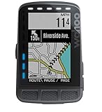
Garmin Edge Explore – GPS bike navigator with the best price-performance ratio

- Einfache Bedienung: Der hochauflösende 3 Zoll (7,6 cm) Farb-Touchscreen des Edge Explore lässt sich dank einfacher Menüführung mühelos bedienen - auch mit Handschuhen und bei Regen. Das Display ist zudem bei direkter Sonneneinstrahlung sehr gut ablesbar
- Ideale Navigation: Auf der vorinstallierten Garmin Europa Fahrradkarte können Sie sich dank umfangreicher Navigation bequem an Ihr Ziel leiten lassen. Fahren Sie auf den beliebtesten Strecken und folgen Sie vorgeschlagenen Rundkursen. Ideal im Urlaub
- Detaillierte Daten: Dank GPS werden detaillierte Daten wie Distanz, Geschwindigkeit oder das Höhenprofil aufgezeichnet. Diese können Sie nach Ihrer Tour auf Garmin Connect (PC/App) ganz bequem auswerten und sich ansehen, wohin Sie Ihre Tour geführt hat
* Werbung - Aktualisierung am 2026-07-13, Preis kann gestiegen sein, Als Amazon-Partner verdiene ich an qualifizierten Verkäufen, Bild:Amazon
The Garmin Edge Explore won me over immediately and it is my current bike GPS navigator.
✅ Full and excellent navigation: Includes route recalculation.
✅ Excellent color touchscreen
✅ 16 GB internal memory: With pre-installed detailed Europe maps and free map updates.
✅ compatible with koomot and Strava (thanks to Connect IQ Apps)
✅ Favorable price
…and many other functions. Click here for the detailed Garmin Edge Explore field test (test & experiences)
Garmin Edge Explore bei Amazon kaufen*
Bike navi test – everything you need to know
I have tested the current bike navigation systems and present them to you here with all the advantages and disadvantages.
With the right bike navigation system you will find the right way on your next bike tour and arrive relaxed at your destination. Good GPS bike navigation systems are easy to use, offer long battery life and are easy to read even in difficult lighting conditions.
Every cyclist has individual requirements for his bicycle GPS navigation system:
- The touring cyclist: The touring cyclist wants to navigate comfortably and relies on automatic route guidance. A power outlet is not always available – so a long battery life is important.
- The road bike rider: He is looking for a GPS bike computer with sophisticated training options. Modern devices also handle comfortable navigation and extras like Strava-Segment
- The mountain biker: He often needs a combination of both worlds. Also, off-road navigation and finding trails is important.
In the bike navi test I show you how to find the best navi for your bike trip.
The TOP 6 GPS bike sat navs for your next bike trip
Garmin Edge Explore
- Einfache Bedienung: Der hochauflösende 3 Zoll (7,6 cm) Farb-Touchscreen des Edge Explore lässt sich dank einfacher Menüführung mühelos bedienen - auch mit Handschuhen und bei Regen. Das Display ist zudem bei direkter Sonneneinstrahlung sehr gut ablesbar
- Ideale Navigation: Auf der vorinstallierten Garmin Europa Fahrradkarte können Sie sich dank umfangreicher Navigation bequem an Ihr Ziel leiten lassen. Fahren Sie auf den beliebtesten Strecken und folgen Sie vorgeschlagenen Rundkursen. Ideal im Urlaub
- Detaillierte Daten: Dank GPS werden detaillierte Daten wie Distanz, Geschwindigkeit oder das Höhenprofil aufgezeichnet. Diese können Sie nach Ihrer Tour auf Garmin Connect (PC/App) ganz bequem auswerten und sich ansehen, wohin Sie Ihre Tour geführt hat
* Werbung - Aktualisierung am 2026-07-13, Preis kann gestiegen sein, Als Amazon-Partner verdiene ich an qualifizierten Verkäufen, Bild:Amazon
The Garmin Edge Explore is an easy-to-use GPS bike navigator at a low price. The navigation functions are excellent and the navigation device has few weaknesses.
To the detailed Garmin Edge Explore field test (test & experiences)

Good
✅ Excellent touchscreen: Clearly readable in any situation – operation possible even in the rain
✅ Logical operation: Even beginners quickly find their way around
✅ Top Navigation: Counts among the best navigation solutions on the market
✅ compatible with komoot and Strava thanks to Connect IQ Apps
✅ Wireless transmission of routes
Bad
❌ No brightness sensor
❌ average battery life (approx. 9 to 11 hours)
Conclusion
The Garmin Edge Explore has a particularly attractive price and is easy to use. The GPS bike navigator offers exactly the features that recreational cyclists need: Full navigation and a clearly readable colour touch display.
Extras include: smartphone notifications that can be turned off and customizable data fields. Thanks to Garmin Connect IQ apps, the GPS bike navigator is also compatible with sports portals like Strava and komoot. The data transmission is wireless.
Garmin Edge 530 and Garmin Edge 830

- PERFEKT ABLESBAR & PER TASTE BEDIENBAR: Das hochauflösende 2,6“ (6,6 cm) große Farbdisplay lässt sich auch bei Sonneneinstrahlung hervorragend ablesen. Per Tastenbedienung navigieren Sie sich durch die vielfältigen Funktionen und Menüs. Gerätabmessungen: 50 x 82 x 20 mm (BxHxT)
- HOCHPRÄZISE DATEN: Dank der integrierten Satellitensysteme GPS, GLONASS und Galileo sowie einem barometrischen Höhenmesser erhalten Sie auf jeder Tour zuverlässige Daten zu Geschwindigkeit, Distanz, Navigation u.v.m.
- INDIVIDUELLE TRAININGSSTEUERUNG: Über ANT+ können Sie HF-Brustgurte, Leistungsmesser und weitere Sensoren koppeln und so Ihr Training steuern. Der Edge informiert Sie über Ihr Fitnesslevel, Ihre individuelle Trainingsbelastung und Ihren Belastungsfokus. Mit Empfehlungen zu Erholungszeiten
* Werbung - Aktualisierung am 2026-07-13, Preis kann gestiegen sein, Als Amazon-Partner verdiene ich an qualifizierten Verkäufen, Bild:Amazon

- Garmin Edge 830 bicycle navigation
* Werbung - Aktualisierung am 2026-07-13, Preis kann gestiegen sein, Als Amazon-Partner verdiene ich an qualifizierten Verkäufen, Bild:Amazon
Garmin Edge 530 and Edge 830 are light and small. In addition, both have a especially long battery life: Both are suitable for particularly long bike tours with about 19 hours of battery life. The Garmin Power Pack doubles the runtime again approximately. The bike navigation is one of the best and it is the Garmin Edge 830 even on par with the Garmin top model 1030. Whereas the Edge 1030 is bigger and more expensive. Both GPS bike computers are capable of Garmin Connect IQ apps. This makes them compatible with numerous online sports portals. Of course, they’re also compatible with komoot and Strava.
To the detailed Garmin Edge 530 field test (test & experiences)
Zum ausführlichen Garmin Edge 830 Praxistest (Test & Erfahrungen)

The following are the main differences: The Garmin Edge 530 relies completely on button operation. The Garmin Edge 830 is operated comfortably with a combination of buttons and touchscreeen. It also handles even more extensive functions in GPS bike navigation.

Good
✅ Large range of functions in a compact housing
✅ TOP Navigation
Display easy to read
✅ reasonable price
✅ Garmin Edge 530: operable in the rain and with gloves on
✅ with Connect IQ Apps compatible with komoot and Strava
Bad
❌ Trailforks integration still faulty
❌ Garmin Edge 530: complicated button operation on the map
❌ Garmin Edge 530: Destination entry limited, e.g. no address entry possible (Garmin Edge 830 has the full range of functions)
Conclusion
Garmin Edge 530 and Edge 830 are especially attractive bike navis: Here full-featured bike navigation is offered and that at a relatively low price. The Edge 530 can be operated via the buttons even in the rain and with gloves well. With the Edge 830, the functionality is particularly large and even superior to the high-end navigator Edge 1030. Thus, the Edge 830 now actually marks the top of the Garmin bike navigation devices.
Both GPS bike computers are absolutely recommendable and offer TOP technology. In addition, they are light, small and offer a particularly long battery life of 20 hours and more.
Garmin Edge 1030

- Beschleunigungsmesser
- Kalorienverbrauch
- Intelligente Benachrichtigungen
* Werbung - Aktualisierung am 2026-07-13, Preis kann gestiegen sein, Als Amazon-Partner verdiene ich an qualifizierten Verkäufen, Bild:Amazon
The Garmin Edge 1030 is the current top-of-the-line GPS bike nav. The Edge 1030 has its price. In return sophisticated navigation as well as training functions are offered.
The GPS bike computer offers modern hardware and the large color touchscreen is almost always excellent to read.
Zum ausführlichen Garmin Edge 1030 Praxistest (Test & Erfahrungen)

Good
✅ Excellent & large screen
✅ Excellent battery life: Only bike navi – up to 20 hours, with battery pack – up to 40 hours.
✅ Top Track Navigation i.e. saved tracks
✅ Advanced features e.g. komoot and Strava (with Garmin Connect IQ apps and widgets).
✅ Many training functions v.a. through Firstbeat integration
Bad
❌ High price
Heavy (123 grams) & Large
Conclusion
Garmin Edge 1030 Experience: The display is excellent and particularly large. The large color touchscreen makes navigation particularly pleasant and easy. The bike GPS computer also has particularly extensive training functions. This also applies to the battery life: With up to 20 hours the GPS bike navigator lasts particularly long. The optionally available battery pack (Garmin Charge power pack)*. can be used to roughly double the runtime.
The Garmin Edge 1030 has a high price – those who don’t shrink back from that get a top GPS bike navigator.
Sigma ROX 12.0 Sport

- FAHRRADNAVI: vielfältige Navigations- und Routing-Optionen, OSM-Fahrradkarten weltweit inklusive; Anbindung an komoot und Strava
- FAHRRADCOMPUTER: Anbindung an Strava, komoot, & TrainingPeaks; individuelle Workouts, 30 Trainingsansichten, beliebig viele Sportprofile, kompatibel mit gängigen Leistungsmesssystemen u. a. mit Rotor 2INpower (OCA, OCP)
- SCHNELLE DATENÜBERTRAGUNG: WIFI Schnittstelle, Synchronisierung der Trainingsdaten zum SIGMA DATA CENTER und Sigma LINK App via Sigma CLOUD, ANT+, Schnittstelle, GPS und GLONASS
* Werbung - Aktualisierung am 2026-07-13, Preis kann gestiegen sein, Als Amazon-Partner verdiene ich an qualifizierten Verkäufen, Bild:Amazon
Until now, SIGMA SPORTS offered rather simple GPS bike computers like the Sigma GPS 11.0.
All the more pleasing: With the top model Sigma ROX 12.0 Sport the German company delivers a very successful GPS bike computer. In my Sigma ROX 12 test I was very excited about the bike navigator.
I particularly liked the simple and sophisticated operation: This is very similar to a smartphone navi and also the map display in the bike navigation is just as fluid as we are used to from a smartphone. The GPS bike computer from Sigma also masters swipe and zoom gestures.
The SIGMA SPORTS bike training computer is also at the top when it comes to connections and maps: GPS, GLONASS and a 3-axis compass ensure fast positioning. Synchronization of activities, for example, to komoot and Strava, as well as the (free) map updates are conveniently wireless WLAN.
If you can handle the battery life of about 9 hours, you will love the Sigma ROX 12.0 Sport.
To the detailed Sigma ROX 12.0 Sport field test (test & experiences)

Good
✅ TOP bike navigation and smooth map display
✅ with microSD cards expandable memory (by up to 128GB)
✅ free map updates directly on the bike navi feasible
✅ WLAN Auto Sync
Bad
❌ thick casing edges around the touchscreen
Battery life only mediocre
Conclusion
The ROX 12.0 Sport is a GPS bike navigator of the upper class. The bike navi is especially suitable for all those who love smartphone navigation and want to switch to a full-fledged bike navi.
Touring and leisure cyclists will be just as happy with the Sigma ROX 12.0 Sport as ambitious road cyclists: Because the bike navigation is at TOP level and the training functions are lush.
In addition, there are plenty of modern features such as wireless synchronization via WLAN, support for komoot, Strava and other sports portals. The map updates are also free and can be performed directly on the GPS bike navigation via WLAN.
Wahoo ELEMNT ROAM
- Wahoo ELEMNT ROAM
- Wahoo Fitness
- GPS OR NAVIGATION SYSTEM
* Werbung - Aktualisierung am 2026-07-13, Preis kann gestiegen sein, Als Amazon-Partner verdiene ich an qualifizierten Verkäufen, Bild:Amazon
The Wahoo ELEMNT ROAM is a GPS bike computer clearly from the GPS Navi upper league.
GPS bike computers from the ELEMNT series are known for extensive training features for road racing cyclists. The Wahoo ELEMNT ROAM is also capable of extensive training functions. New is the greatly improved navigation.
The bicycle GPS navigator is therefore also suitable for mountain bikers and touring cyclists.
To the detailed Wahoo ELEMNT ROAM field test (test & experiences)

Good
✅ good color display with switchable illumination.
✅ Bike navigation now greatly improved (incl. rerouting)
✅ thoughtful button operation
✅ Sport portals (Strava, komoot etc.) well integrated.
Bad
❌ 2GB non-expandable memory
❌ Scrolling on map not possible during navigation
Conclusion
Wahoo builds with the ELEMNT ROAM the GPS bike computer with the best display so far. The screen offers excellent readability in almost all situations. The navigation has also been greatly improved: The bicycle navigation is now practical and offers the newly calculated route in case of route deviation. However, the internal memory is tight. The setup via smartphone is quick and easy and the bike GPS navigator can be operated precisely via the housing buttons even while riding. Sports portals such as komoot and Strava are integrated in a sensible way and thus an enormous range of functions is available.
The GPS bike computer is therefore particularly suitable for cyclists who want to follow pre-planned tours and use the various training functions.
Comparison Table – Bike Navi Test
Follows
What should I look out for when buying a bike sat nav?
Operation
How easy is it to use the bike navigator? Are the menus logically structured and well thought out? Can I quickly access the function I want or is it fiddly to use?
Modern devices can usually be operated conveniently via a touch screen. A few can also be controlled via buttons on the device. The line address can usually be entered directly on the device via a display keyboard. Or you can select saved favorites.
For complex route planning, most devices sync wirelessly with route planning software like komoot.
Display
How big is the Navi display and how clear is the display? How quickly does the sat nav respond when you press a button or tap the touchscreen? Is the screen easy to read even in difficult lighting conditions?
The display should be easily visible even in bright sunshine or in difficult light under a canopy of leaves in the forest. Contrast is also important: it makes it easy to see details on the map and turnings.
Navigation – Comfort and accuracy of navigation
Which maps are installed and what is the size of the maps? Which countries are installed? Most navigation systems have countries such as Germany, Austria, Switzerland and neighbouring European countries pre-installed. A reload of worldwide maps should be possible free of charge.
How detailed is the information on the map? Are there topographical maps? Can maps from OpenStreetMaps be used free of charge? How good are the route suggestions of the bicycle GPS navigation system? Can you change the route at any time later? Are there trail profiles for different bike types and preferences like fastest trail, road bike, touring bike, with gravel, mountain bike.
The quality of the map display during navigation and the fluidity with which the navigation is displayed also play a role here.
Which satellite system is supported? If the bike navi uses several technologies to determine the location, then it can idR. determine the position faster and is more accurate in difficult situations such as in the forest. Satellite systems that can be used are GPS, GLONASS, BEIDOU Galileo and QZSS.
In the bicycle navi test I clarify these questions
Storage space on the device
How much memory is available for map material? Is the built-in memory sufficient and if not, can the memory be easily expanded via microSD card?
Almost all bicycle navigation devices have enough space for Germany and the neighbouring countries. Having a large number of country maps stored on your bike navigator can sometimes be useful: If you are going on a long tour through several countries or just don’t want to deal with moving and downloading maps.
Bike Navis with removable memory can usually be upgraded with up to 128 GB microSD cards. With this memory size, several continents can be stored completely on the bicycle navigation system, which should be more than sufficient for almost everyone in practice.
Usage time, battery life
How long does the battery really last on tour? How does the battery life behave in practice? When does the battery die?
Especially those who ride long bike tours should pay attention to a long battery life. Battery life can also be important on cycling holidays and when bikepacking – because a power socket is not always available when you are travelling with a tent.
With a long battery life or with the right charger, you don’t have to do without the navigation device even on the second day of the tour.
Therefore, you should not forget the charger for the bike GPS Navi! Luckily, most bike sat navs can be easily charged via a USB charger or powerbank.
Many devices have a permanently installed battery. Then a large battery capacity is particularly important. The battery can then not be replaced but you can charge the device during navigation with a powerbank.
A good bicycle navigation device should last 10 to 12 hours and longer. The battery life in practice I have tested in the bike navi test for you.
Follow-up costs – Free map updates
An important question to ask yourself when buying a GPS bike navigation system: Which map material can be used? And can the Navi maps be updated for free?
In the past, map updates were often chargeable. Meanwhile, map updates are free with most manufacturers. Garmin Navis, for example, can be used with the free OSM maps and sells its devices with lifetime map updates.
The map material may already be out of date when you buy a bicycle GPS navigation system. Therefore, most manufacturers have moved to the free update solution.
Weatherproof and splashproof
How can the device be controlled and read in wet conditions?
A rain shower or thunderstorm can come up quickly while cycling. All the better if the new bicycle GPS navigation system is not immediately rendered unusable by the first drop of rain. At the core, there are two things to consider:
- Weather resistance of the Navi: The Navi should not only be splash-proof but almost waterproof. This way you can be sure that it will survive even a heavy rain shower safely and without water damage. There are so-called IP protection classes. These indicate the degree of weather resistance. Mostly current devices are protected according to IPX5 and better.
- Touch Screen Operation:Lorem Ipsum
Mounting the bike GPS Navi on the bike
Most of the time, the bicycle navigation device can be mounted quite easily: The device is mounted either on the handlebar or on the stem. The attachment works either with rubber bands or with special holders. The assembly is very simple and you need either no tools or an Allen key.
Before buying, be sure to check the scope of delivery: there are devices for which certain brackets must be purchased separately. This increases the purchase price for you.
Which brackets are supplied? With good navigation systems, both mounts are included in the scope of delivery – i.e. the mount for the handlebar and the mount for the stem.
Extra features: Smart notifications, sports portals, training functions, TMC
- Smart Notifications: Incoming messages, e.g. from messengers such as WhatsApp, and call information can be displayed on the navigation device. Some users find this convenient – for others, the function is annoying. Smart notifications can also be turned off.
- TMC: TMC stands for Traffic Message Channel. This VHF signal is used to broadcast information about traffic incidents. This information can then be used for route guidance. Your navigation system can then, for example, avoid a traffic jam.
- Sports portals: Modern bike GPS computers are connected to sports apps and portals. Pioneers in portals are Strava and komoot. With these extensive services, tours can be planned conveniently on the computer or smartphone. Alternatively, performance data of the training or tour information can be extensively evaluated. Sports portals are either integrated directly into the navigation device or can be retrofitted via apps. In most cases, data synchronization works wirelessly via WLAN or Bluetooth.
- Training functions: Advanced bike GPS navigators offer extensive training features. They show you information about your cadence, speed, heart rate and your power in watts. If desired, this information can be recorded. In sports portals such as Strava or on the navigation device itself, the evaluation is then carried out later. These functions are ideal if you train in a targeted manner and evaluate your athletic progress.
This is how it was tested
If you are looking for a suitable GPS bike navigator or GPS bike computer, then the overview is quickly lost in a sea of products. There are now almost infinitely different options for bike navigation – each solution makes different promises and ultimately you have your own unique requirements.
With this test I would like to help you find the right GPS bike computer for you. So the first thing I did was to get an overview of the seemingly endless and sometimes overwhelming choices on the market. Some really good bike navis have already proven themselves in long practical use with me. I also took a close look at the current top models.
Compiling an extensive product list was the first step. Then I checked out trusted online platforms and then scoured Amazon for top rated products. Thus, I was able to narrow down the test field to the top bicycle navigation devices.
Once the test lineup was complete, I compared the GPS cycling computers, carefully considered their pros and cons, and subjected them to months of field testing.
Overall Conclusion and Summary – Bike Navi Test
This is what a good bicycle navigation system is all about:
- Long battery life
- Easy to read display with good contrast
- Sophisticated and simple operation – even while driving


